Bluetooth LE advertising congestion happens when there are too many Bluetooth devices in an area. As we will show, this rarely happens but with new Bluetooth technologies this situation is becoming more likely. We provide some ways to mitigate congestion.
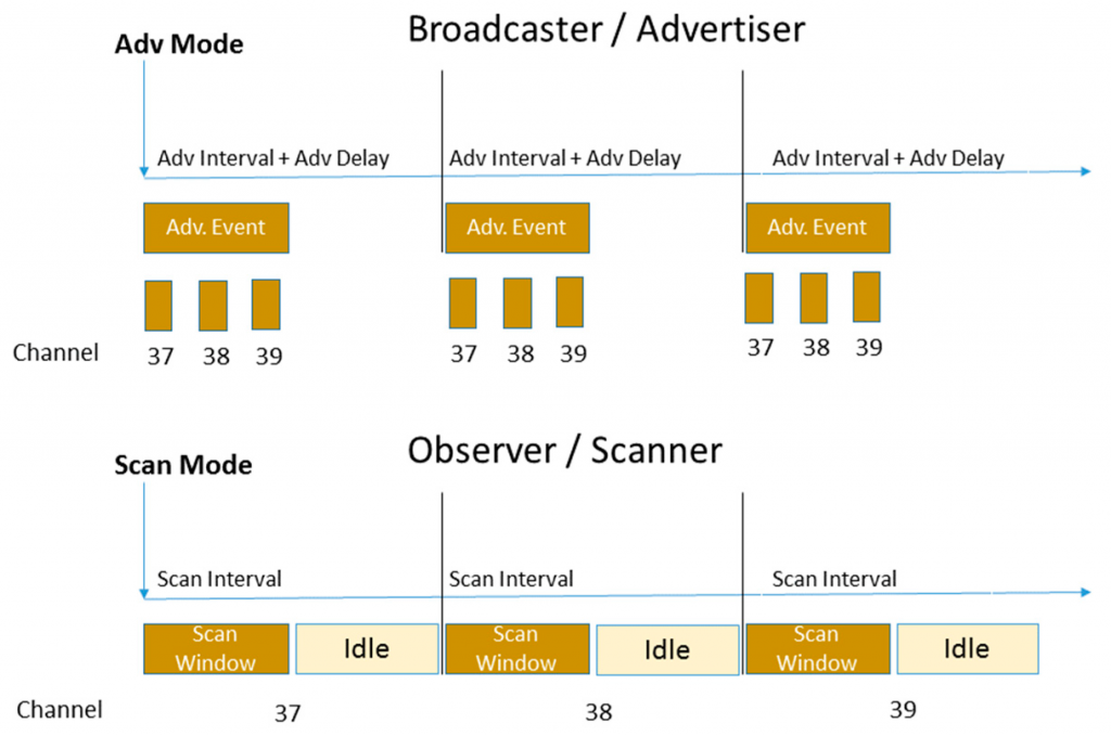
Bluetooth LE advertising transmits periodically the period of which is configurable from typically 100ms to about 10 seconds.
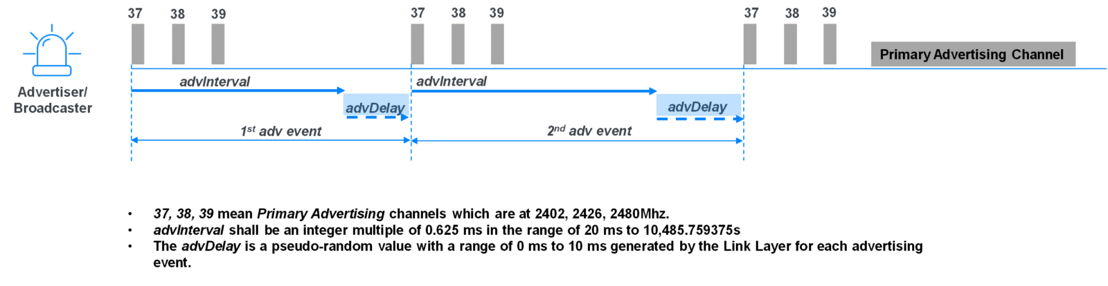
If two Bluetooth devices happen to transmit at the same time, it’s like two people shouting at the same time. The signal is corrupted, the receiver can’t make sense of the signal and it is lost. This usually doesn’t matter because it’s likely the signal is seen the next time it is sent. The random advDelay in the above diagram ensures that the two sends don’t clash again. It’s very unlikely advertisers clash in the first instance because the transmit duration is very small compared to the advertising period. The above diagram isn’t to scale. Here’s an oscilloscope trace showing some real timing:

The advertising duration is very small, of the order of 1 to 2 ms (milliseconds). Advertising is also sent three times, on three different radio frequencies, so that if one is blocked, the radio signal might be heard on one of the others. All this means that advertising collisions rarely occur.
However, there are some newer Bluetooth protocols that as they are starting to roll out, are making collisisons more likely:
- Bluetooth 5 advertising extensions – This allows advertising of more data, that takes longer than the typical 1 to 2 ms and hence increases congestion.
- Bluetooth longer range – This transmits further thus effectively increasing the number of beacons advertising in a given area.
- Bluetooth Mesh – This works by having relay beacons listen and re-transmit advertising, usually several times, to improve reliability.
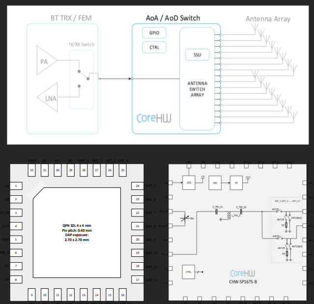
- Bluetooth direction finding – This also has longer advertising to send a constant tone extension (CTE) that is received by AoA hardware. However, of more affect is advertising more frequently. While beacons on assets used to advertise typically every second or longer, direction finding tends to use faster advertising to improve latency.
You can check how many devices are advertising by using a scanning app on Android. We recommend Nordic Semiconductor’s nRF Connect because it can decode the latest Bluetooth protocols. Use Android for full visibility because Apple made the poor design decision to obfuscate iBeacon advertising to coerce developers to only use the Apple iBeacon-specific APIs. Apple also hides devices’ MAC addresses making them more difficult to physically identify.
If you have a problem with congestion you might be tempted to increase the transmission power or advertise more often to increase the chances of being seen. However, this is counter-productive because you will be increasing congestion, especially if your devices are the main contributor to the congestion.
Instead:
- Lower the transmit power so that beacons cover a smaller area. You can fine tune this using nRF Connect to measure the distance you need rather than needlessly advertising further. This will also conserve battery life.
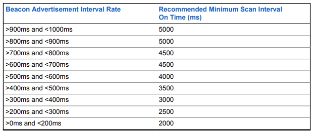
- Increase the advertising period to make collisions less likely.
- Increase the receiver scanning period to make detections more likely.
- Seek out and remove unwanted devices advertising too frequently, such as fitness devices, smartphones, displays and even cars.
Need more help? Consider our consultancy services.